|


|

Depok, August 4, 2026 — The severity of earthquake damage is not determined solely by a location’s distance from the earthquake’s epicenter. Local soil conditions and geological characteristics often play a much greater role in determining the intensity of ground shaking and the extent of the resulting damage.
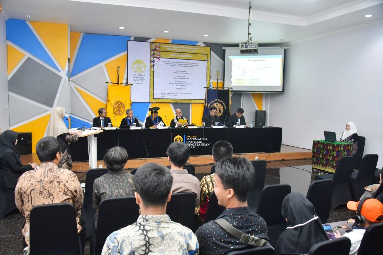
These findings were revealed in the doctoral dissertation research of Frilla Renty Tama Saputra, a doctoral candidate in the Physics Study Program at the Faculty of Mathematics and Natural Sciences, Universitas Indonesia (FMIPA UI). The research, titled "Analysis of Site Effects Based on a Multivariate Approach in the Kalibening Basin-Hill Transition Zone Using Microtremor HVSR and Gravity Data," was defended during the doctoral promotion ceremony held at the Prof. Dr. G.A. Siwabessy Hall, FMIPA UI, Depok, on Friday (July 10, 2026).
Frilla earned a Doctor of Philosophy (Ph.D.) in Physics with the distinction of Highly Satisfactory after successfully defending her dissertation before the examination committee, chaired by Prof. Dr. Tito Latif Indra, M.Si., with committee members Adhi Harmoko Saputro, Ph.D., Dr. Anne Meylani Magdalena Sirait, and Dr. Sigit Pramono.
The research was supervised by Promoter Prof. Dr. rer. nat. Imam Fachruddin, S.Si., M.Si., with Co-Promoters Prof. Drs. Mohammad Syamsu Rosid, M.T., Ph.D. and Dr. Titi Anggono from the Research Center for Geological Disaster, National Research and Innovation Agency (BRIN).
The study was motivated by the unusual characteristics of the Kalibening Earthquake that struck on April 18, 2018. Although the earthquake had a magnitude of 4.4 and a very shallow focal depth of approximately 4 kilometers, it presented a puzzling phenomenon: the pattern of damage observed in the field did not correspond to the distance from the earthquake's epicenter.

Severe damage was concentrated in the eastern hilly region, which was relatively farther from the earthquake source. In contrast, the Kalibening Basin, located closer to the source and characterized by softer sedimentary deposits, experienced comparatively less damage.
“The damage pattern observed during the 2018 Kalibening Earthquake shows that neither the distance from the earthquake source nor a single soil-condition parameter alone is sufficient to explain the earthquake's impact. Ground-shaking response in a given area is influenced by a combination of subsurface conditions, topography, and local geological structures,” said Frilla.
To investigate the cause of this damage pattern, Frilla analyzed microtremors—small, continuous ground vibrations that naturally occur at the Earth's surface—using the Horizontal-to-Vertical Spectral Ratio (HVSR) method. This analysis was used to assess how soil conditions and subsurface geological structures influence ground shaking during an earthquake.
The study also compared a number of parameters, including average soil stiffness up to a depth of 30 meters (Vs30), sediment thickness, impedance ratio, basin basement geometry, and topographic conditions. Gravity data serve as supplementary information for understanding subsurface rock density variations and subsurface structures, such as faults and the boundaries between basins and hills.
The study revealed significant differences in the geological characteristics of the Kalibening Basin and the surrounding hilly areas. Although the basin is dominated by thick sedimentary layers and softer soils, it did not experience the strongest ground shaking. Instead, the highest amplification values were found in the hilly region, which is characterized by harder soils and thinner sedimentary deposits. Notably, these areas closely coincided with the locations that suffered the most severe damage during the 2018 earthquake.
“A key finding of this study is that site response is highly localized. In the basin area, soil stiffness was the most consistent factor explaining variations in ground-shaking amplification. In contrast, the response in the hilly region was more complex and was likely influenced by heterogeneous shallow soil layers, slope conditions, and the interaction between seismic waves and local topography,” said Frilla.
According to Frilla, the findings highlight the limitations of relying on a single parameter, such as the average shear-wave velocity in the upper 30 meters of the ground (Vs30), to assess ground-shaking potential in areas with complex geological conditions.
A multivariate approach, which considers multiple parameters simultaneously, was found to provide a more comprehensive assessment of site effects—the influence of local ground conditions on the intensity of earthquake shaking—particularly in basin areas.
These findings are highly relevant to Indonesia's efforts to strengthen earthquake disaster mitigation. As a country located in a tectonically active region, Indonesia is exposed to earthquake hazards across many areas. However, the extent of earthquake damage can vary significantly from one location to another, even within the same shaking zone.
Therefore, a more detailed understanding of local soil conditions and subsurface geological structures is essential for improving seismic hazard mapping, spatial planning, and the development of more earthquake-resilient infrastructure.

Frilla's research can serve as a scientific reference for the development of seismic microzonation, which involves mapping variations in earthquake hazard at a more detailed local scale. The findings may also help identify areas that require greater attention in building assessments and the development of earthquake risk mitigation strategies.
“This approach can provide an important basis for identifying areas that should be prioritized for earthquake mitigation. It is not sufficient to consider only the distance from the earthquake source or a single soil classification; local geological and site characteristics must be evaluated more comprehensively,” said Frilla.
Nevertheless, Frilla emphasized that the findings of this study need to be complemented with additional geotechnical and geophysical data, including actual earthquake recordings, to strengthen the validation process.
In the future, the research findings can be further developed to support the preparation of site-condition-based seismic microzonation. Hilly areas that show relatively high ground-shaking amplification and have a history of significant damage can also be prioritized for building vulnerability assessments, disaster education programs, and spatial planning that takes local geological conditions into account.